Monday, October 5, 2026

Hawa Hawaii... Kaua'i the Aloha State!!!!

Hawaii islands have been always the most sought after destination for all Desis'. I would be racist by saying that but none the less the craze is amongst all the tourists. I earlier had a feeling about Hawaii as a tick mark travel destination but after visiting Kaua'i, my this very imagination was replaced with some beautiful memories just like Grand Canyon.

Hawaiian islands are a group of 8 main islands with 4 counties. Through there are multiple other islands not all are uninhabited. The 8 main islands are:

1. Hawaiʻi (the Big Island) where the volcanic activity is the main attraction and the Volcanic National park and the southmost in the chain and the biggest amongst all the 8 islands. This is a separate county 

2. Maui, comes just above the Big Island on the map and a separate county with 3 other islands Molokaʻi, Lānaʻi, Kahoʻolawe. Kahoʻolawe is uninhabited as it's a bombing site for the US Military and tourists are not allowed to visit this island. 

3. Oʻahu, comes above Maui on the map and below Kauaʻi island and this island is famous for Honolulu & Waikīkī. Honolulu is the capital of Hawaiian Islands. Pearl Harbor is the main historical attraction 

4. Kauaʻi island is the northmost island in the chain on the map and shares a county with island Niʻihau. Niʻihau island is owned privately by the Robinson Family and one needs an invite from the family to visit that island.  


Information Courtesy: by the Librarian at Kapaʻa Public Library, Kauaʻi

The trip was planned during Kids' fall break and an off season so definitely not crowded. I selected the less commercial and the northmost island amongst the group of Hawaiian islands - Kaua'i. It's said that "Kaua'i - where the time slows down and the nature speaks"... It's the reality we felt and experienced. Time was really slowed down due to 5 1/2 hrs flights from SFO to Lihue. Lihue is a small airport in the middle of a sea ("Moana" in Hawaiian language) with a backdrop of mountains ("Mauna" in Hawaiian language) but very very simple. Ofcourse all the other facilities are available like Car rental, shuttle, etc. The trip was planned for 3 nights and 4 days which is quite enough time to cover the complete island depending on the rain. 

Jokes apart but the moment plane started descending and we were out of cloud cover suddenly the mighty Emerald Mountains surrounded by the turquoise water with spume. I always admired the natures' beauty either through the youtube travelogs or National Geography documentaries but this time it was real!!!! Witnessing that through your own eyes is totally unforgettable. That moment I was super happy with my choice. Perfecto!! This is virgin beauty not impacted by the towering resorts or any kind of commercial stuff! Rather there is no road to visit the West Coast of this Island. "The NaPali Coast"..It can only be visited by the fairy. 


Day1:

The flight arrived at 9:30am HST. The fun fact - we were traveling first time ever to the time zone which is behind PST and that too by 3 hrs!! Our AB&B check in was at 4pm at Princeville which is the north side of the island just 31 miles away from Lihue airport but the travel time is more than an hour due to the reduced speed limits and mostly single lane roads. As per the plan we were supposed to cover the south side as much as possible and given the sunny day we targetted the Waimea Canyon State Park first. Waimea Canyon,  also known as the Grand Canyon of Pacific. The scenic treasure of the state – the deep, colorful gorge of Waimea Canyon stretches 10 miles long and 3000 ft deep. The canyon got it's name from the red soil erosion. "Waimea" means reddish water in Hawaiian language. The road to the Waimea Canyon State Park is another postcard view. 

The major lookout points were unfortunately closed due to the hurricane impact and for the safety of the tourists. but we were able to check the Waimea Canyon Lookout. 


The other lookout points for beautiful views of the canyon and the coastal side are - Puu Hinahina Lookout, Kalalau Lookout.                                                                                            

This state park is not connected from the west side of the island as there are no roads. One has to come down south to visit this state park. So the residents on the north side have to plan accordingly with the travel time. There are different strength hikes as well in the park to explore but due to the hurricane impact we couldn't explore any of the trails.  

After the state park was a beach time - first halt was at Spouting Horn. Those are the geographical formations due to the erosion of the seaside rocks. The speedy waves bang on those rocks and run through the holes creating marine geyser like feel. I would highly recommend visiting this geographical wonder. 


By 6pm, after an hours drive we reached Princeville city on the northside of Kauaʻi island and noticed that's another hidden gem of Kauaʻi totally different from south!!! We could witness the reason why Kauaʻi is often called as Garden of Isle!! Endless shades of green stretched farther than eye could see. Silver ribbon cascades making their way down ancient cliffs of mighty Mauna s and one side completely accompanied by the roaring Moana. 


Food:

For the tourists who would like to prep their own meals Coscto is around 8 mins away from Lihue and also has Walmart, Safeway for retail shopping. But mind the prices, being an island the grocery prices are way higher than the mainland. 

Not to miss:

A) Farmers Markets 

Specially for the fresh fruit produce with unbeatable and unforgettable taste..Not all the farmers markets are held daily. The markets have scheduled time and days. One can see the farmers market schedules here. Coconut Marketplace at Kapaʻa is highly recommended farmers market and a local shopping place.It also hosts 

free weekly hula and Polynesian dance shows featuring fire knife performances on Wed, Thu and Fri.

B) Local treats/Desserts in Bakeries

Haupia Pie (a popular Hawaiian dessert featuring a rich pie crust filled with a layer of fudgy chocolate and a firm, creamy coconut pudding). But one needs to order atleast 24 hrs in advance to get this pie at the Right Slice Bakery the most sought after place. I was fortunate enough to get a taste of a pie slice at another bakery right across the street at Kauaʻi Kookie Bakery and Kitchen at Kalaheo.


Lilikoi Cheesecake made up of Passion Fruit. 


Additionally local food trucks serve authentic local Hawaiian food (Tacos, seafood, Chicken, Pork). Japanese, Thai cuisine restaurants are pretty common. 


Fun Fact:

You would be surprised to see the number roosters roaming around. Be it on an airport, marketplace, shopping mall or your hotel lobby, you see them everywhere. Based on the local information this happened because of major hurricanes back in 90s. The hurricanes released thousands of domesticated chickens into the wild because of destroyed residential chicken coops across Kauai. Additionally there are no natural predators. Mongooses were introduced to islands but the count is not that high. Introduction of Mongooses has it's own repercussions but surprisingly the localite mentioned that there are no snakes in Hawaii which I doubt!!

Day2:

How can one fall a sleep in such a natural rare wonder?? I wanted to catch a sunrise as sunset was not in my destiny due to the cloudy and rainy weather. Aah forgot to mention that there was no need of an alarm clock because the natural Rooster loud crowing "Cock-a-doodle-do" around 5:30am HST was there right before the dawn!! I got up from the bed and hit the emergency exit to catch to event. Headed towards the lush green golf course ending directly in the sea... The east side was already getting ready for the dawn with orange spray in the sky whereas the Mauna s on the other side were still sleeping in the fluffy delicate cloud blanket. Both the scenes were just nature's postcards. 


Fortunately Coconut Place Farmers market was held from 9am-1pm at Kapaʻa. So we drove to Kapaʻa. Fresh local fruits, jams, handicrafts were displayed by the local farmers. The sweetness of Papaya and Mango are still lingering on the tongue. There are variety of local art shops, art studios, restaurants. There is a lot of support for the local art and craft. Especially sewing. Singer has a special outlet. 

We headed to Poipu beach for the snorkeling as the hurricane alert got moved to the next day. The Poipu beach has a rock covered safe and shallow area where one can sight nice fishes and turtles and just in a 2 ft to max 3 ft deep water. For nice coral sightings there are other beaches. The best bet is NaPali Coastal tour with snorkeling which lasts long for almost 4 1/2 hrs either morning fairy with lunch or afternoon fairy for the sunset. Based on the information provided by the life guard the turtles start coming after 3pm or after sunset on the beach and rest there overnight. At a time one can sight more than 50-60 turtles on the beach. We were lucky to see the seals in natural habitat and playing nicely on the shore. One of them was deep asleep. Admiring thing is the nature, wildlife is taken so seriously and not at all disturbed. One can definitely understand that with the below shots....


Another unique thing that was spotted at the Poipu Beach State Park entrance. Ancient/historical statues which resembled to some Latin American Deities. After checking the information on the boards I got to know that there is a linkage to Tahiti - back to Polynesian Societies in pacific.  


As mentioned by the lifeguard the turtles started showing up on the coast after 3pm and that was another unforgettable moment with the wild life so close..  mini version of Galapagos. 


Enroute to Princeville we took a small detour to enjoy the scenic Wailua Falls. The lookout point is at dead end of the road and the fall is visible from the safety railings. 


Day3: 

After roaming around and covering the majority of southern part we planned to cover the northern part of the island. The road ends at the Haena State Park and this is also the way to enter the Na Pali Coast State Park but through a long stretch of a trail. The NaPali Boat tours start from Hanapepe which is on the southern side of the island. Due to the hurricane all the coasts, beaches and state parks were closed for the tourists on the northern side of the island. 

Hanalei Bay was an exception to the rule. We were able to visit the Hanalei Bay pier to have an amazing glimpse of the mighty mauna s with cloud cover and beautiful threads of cascades the left and the merging point of Hanalei river to the Pacific on the right. Another memorable and scenic place which a must go destination. 


Tunnels Beach and Anini Beach are also scenic and can be visited on the go. Next in the line is Kilauea Point Lighthouse and National Wildlife Refuge. Another view of Pacific from the lighthouse. Na Aina Kai Botanical Garden is another beautiful place to visit. 

This was our last evening at Kauaʻi and I wanted it to be memorable for the family so planned a surprise Luau experience with Smiths Family - Garden Luau along side the Wailua river. This is a family business run over 80 years and now it's the 4th generation into the business. Our booking included a garden tour, beautiful landscapes, Hawaiian style hospitality "hoʻokipa", the real spirit of Aloha, witnessing Imu ceremony followed by the authentic Hawaiian dinner with kālua Pork and Luau show. 


The Imu ceremony is a traditional ritual where the whole kālua pig is roasted in an underground oven and demonstrated to the tourists. The same kālua pork is served as a part of the dinner. Interesting fact told by Kamika Smith (who is heading the Smith Family business now) during the Imu ceremony - There are no more Pig farms in Kauaʻi post Covid and the Pig is imported from Oʻahu island just for the Imu ceremony show. The dinner had a good spread  (Chicken, Beef, Pork, Steamed veggies, salad, rice, fish) and the desserts were really yummy Haupia (Hawaiian coconut pudding), fresh cut fruits like Pineapple and Watermelon, Papayas with a unique taste which you will get only here on Hawaiian Island. The coconut cake was served specially by the elderly grandma (92 years old) from Smith family. 


It was really an amazing experience to witness how the family is running this business with such an intense and lovely hospitality. The servers, cooks were from the family catering the needs of more than 100 people at a time being wonderful hosts. Announcement was done "If you are done with the dinner you can join the Luau dance steps on the live band." I did not miss this opportunity to learn few steps and enjoyed the local vibe. Again the dancers were from the Smiths Family. Special announcements were done by Kamika Smith in the honor of couples who were out there for honeymoon, birthdays and couple celebrating 50th anniversaries. What a lovely and lively event..The dinner ended and the excitement for Luau performance increased. The show started with the history, information about the Deity Tahiti and the beautiful Luau dancers showed up. The Luau consisted traditional local Hawaiian Hula dance, Fire dance. The family also had linkage to New Zealand and Philippines so the Maori and "Tinikling" dances were also performed. Overall it was a variety show under one roof as the Hawaiian roots belong to multicultural people. We all enjoyed the hospitality, welcome in a traditional "lei" (Floral Garlands) symbol of love, friendship, respect, and the spirit of aloha. 


The story of multicultural immigration goes back to the 19th century. It was a "Sugar rush" in Hawaii around 19th century when sugarcane plantations transformed the Hawaiian island's economy and attracted multicultural immigration. Especially British brought workers from Japan for the Sugarcane plantations. Over the period of time the industry couldn't sustain with the increased foreign competition and low cost produce import. The sugarcane plantation business ended up in 20th century.   

The hurricane Nolo hit the Hawaiian islands few days back before we landed. The signs of nature's aggression were clearly visible on the roadside. But everything was very well taken care of by the local government and well managed. Being the touristy place it was definitely hard hit as many tourists canceled the trips, the hotels had to refund the bookings, airline business was impacted and that's why there were lot of promotions going on to invite the tourists back. 

I was really impressed how closenet and respectful the Kauaʻi locals are to the nature, wildlife and overall preserving their culture and heritage. This was concluded based on my interaction with the resort travel counselor Kamaran who is a local Hawaiian born and brought up but in Oʻahu. When I inquired if there is a fairy facility between the islands as the distance between some of the islands is not much, Kamran mentioned that the fairy facility was there in the past. But once, the fairy accident caused a death of a whale and also lot of oil and air pollution that harmed the marine life and overall nature, it was forced to shut down by the local protest leaving behind the selfish convenience. This is a sole respect towards nature and preserving the ecosystem and keeping wildlife intact. Wish everyone in the world thinks this way life would be much better.....

It's very difficult to digest the fact that now it's the time to go back to the real world as the trip was ending. Such unique trips are always a revitalizing tonic for rejuvenation. For us it was a much needed break.  

Kauaʻi is the place where the nature remains gloriously untamed. From the dramatic cliffs of the Na Pali coast (which we could witness only from the flight) to the lush green eye catching valleys of Hanalei and the awe inspiring vistas of Waimea Canyon, everyday felt like stepping into a nature's landscape postcard. Feeling of connection to the nature, uniqueness, Tranquility, Serenity,  Calmness and the most catchy thing simplicity that accompanied every moment made Kauaʻi magical!! I think the list of beautiful adjectives will not be enough to describe the Kauaʻian beauty....

I can just say "Mahalo" and "Aloha" Kauaʻi!!!


Sunday, July 25, 2021

National Parks Passport Part - 7 : Crater Lake National Park

Crater Lake Visit was supposed to be a family visit scheduled back in 2020 Memorial Day Weekend. But the whole world faced unprecedented times and got stranded in the COVID-19 pandemic. The pandemic we ever thought of that squeezed the whole world gradually in it's arms. We had to cancel our scheduled visit and the booking with AirB&B. It took us exactly a year to reschedule the same visit with a little hesitation and fear at the back of our minds to step out of our home. As the restrictions were loosened and the doors opened for the fully vaccinated people, we dared to take a step forward and drove down to Mount Shasta as our base location to cover Crater Lake National Park, Lassen Volcanic National Park and the tourist spots around Mt. Shasta. 

We booked a Air B & B at McCloud (City of 1000 just 9 miles away for Mt. Shashta). Unfortunately the weather was not supportive because of a severe heat wave in North-West and just few minutes back when we arrived at Mt. Shashta the wild fires begun. We could see the fire blow from Lake Siskiyou beach area. The fire was named as Lava Fire as the smoke patten coming out resembled to the smoke when Lava Erupts. The wild fires were because of excessive heat. 

Lava Fire

Lake Siskiyou is a scenic lake and has various vista points, including the one known as "Mirror Lake" where one can see Mount Shashta image in the lake. There is a designated campsite with the electric hookups, cabins around the waterfront, boating activities. There is an entrance fee to enter Lake Siskiyou beach area and same entrance serves as an entrance to the campsite. 

https://lakesiskiyouresort.com/

Mt. Shashta from Lake Siskiyou 

There few more to dos around Mt. Shasta area:

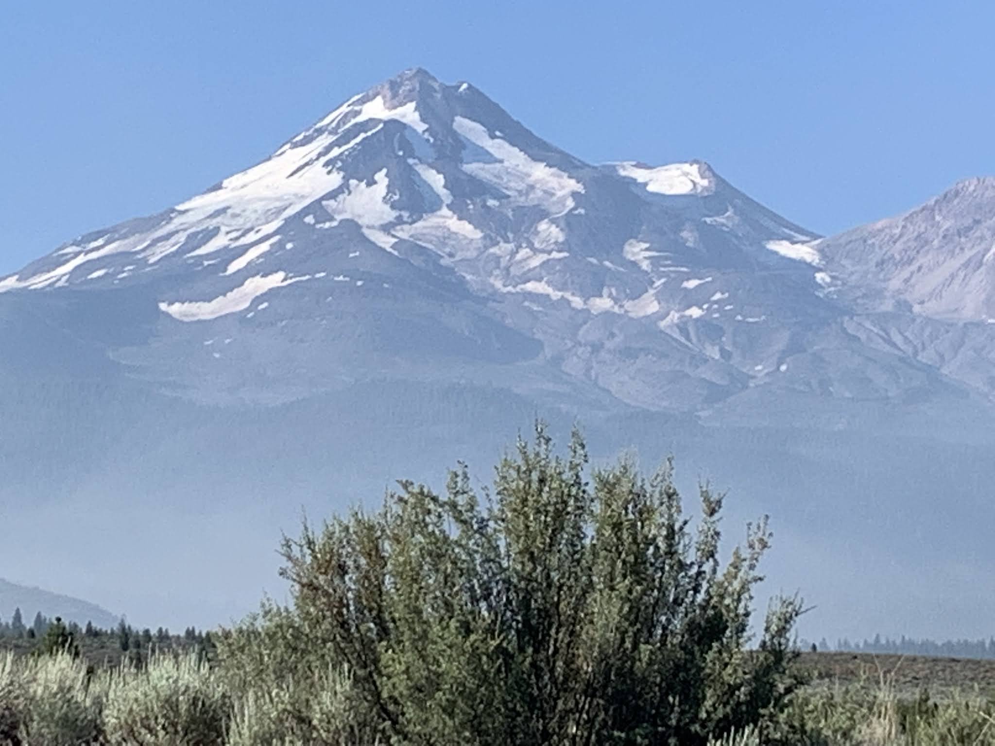
Upper Falls and Lower Falls which are around Mc Cloud area. Mc Cloud is located at a convenient location with the local grocery shops and restaurants just at the Shashta foothills. So great gateway to the ski park. We could locate Mt. Shasta easily even when we stepped out of our Air B & B. 

Mt. Shashta
Mt. Shashta

Burney Falls:
McArthur Burney Falls State Park is another must visit within a half an hours drive enroute Lassen National Forest. The state park has $10 entrance fee. This is another cascade that soothens the rocketing temperatures as you reach closer and closer. There is a sudden drop in the temperature once we reach down the actual falls. The cascade water is deep green, crystal clear. It's a great relief and relaxing feel to have cascade water sprinkles on you. 

McArthur Burney Falls

Crater Lake:


Here is a short background behind Crater Lake formation:
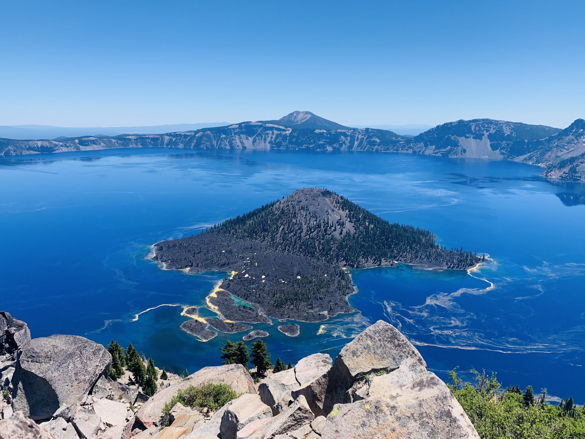
Half a million years ago, a volcano began to grow here and each eruption created new layer of lava and ash to the surface ending up into an outcome of "Mount Mazama". Around 7700 years ago Mt. Mazama had the biggest eruption ever which led to a big hole beneath the volcano where all the lava was. The top of the Mt. Mazama fell right down into the hole and the mountain disappeared! Rain and snow began to fill up the empty crater and the depth pf the water reached 2000 ft! Exactly same time small eruption formed Wizard Island. 


Crater Lake in Oregon State is located at around a 3 hrs drive from Mc cloud This National Park is a one day visit unless one needs to do more hiking trails and explore the park at own pace. There is a $30 entrance fee during summer for the private vehicles which can be booked online. If you are national park passholder then the pass covers the park fees. 

https://www.recreation.gov/sitepass/2647

The park is open year round but during winter the rim roads (East Rim and West Rim) are closed due to the snow. The Rim Village Visitor Center is right across the lake view and few more scenic view points. The east and west rims are generally opened by the end of June subject to the snow conditions and the snow on the trails. The Watchman Post Lookout Point is the best watch point to have an overall lake view in one go. It's a one stop shop. The trail is little steep (1.6miles round trip) and it's suggested to carry water as there is no water fountain enroute. 

Watchman Post Lookout on the top of the mountain


Wizard Island from Watchman Post Lookout Point

Cleetwood Clove is the only legal access to the lake shore. It's a steep and strenuous hike of 1.1miles with a drop of 700ft. in elevation. The boating and fairy activities are halted due to COVID-19 Pandemic and also with the biological scientist experiments going around in the lake. The boat tours are available during July-October. 

There are two more scenic lookouts right across the Rim Village Visitors Center. The Sinnott memorial Overlook is one of them. 

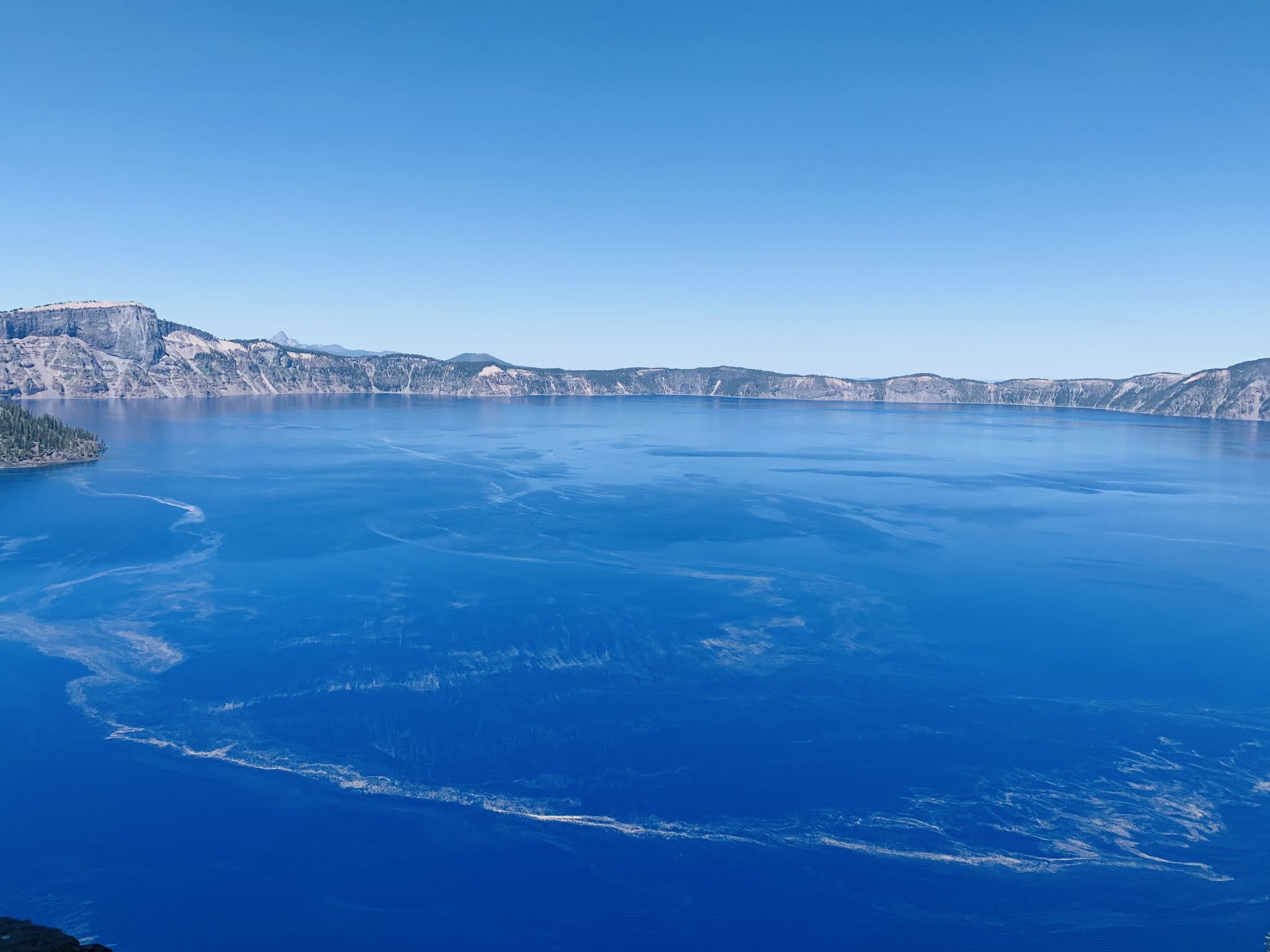
View from Sinnott Memorial Overlook

For the Junior Rangers there is a special program designed by the National Park rangers. It's designed for the ages 6-12. Kids can participate in the program and complete atleast 8 pages in the activity book to get the Crater Lake Junior Rangers Badge. It's a great way to introduce our kids to the National Parks and get mingled. That way they can get closer to the nature and also understand the urge behind conservation of ecosystem and our national parks. After completing the activity book, kids need to submit it with the park ranger at teh visitors center office (At present at the entrance to Sinnott Lookout Point) and answer the questions asked by the park ranger. The badge is awarded after the oath ceremony. 


Crater Lake is a real deep blue and the purest, untouched, preserved form of water. The beauty differs by the season. Oregon is really blessed with a Sapphire bounty in it's heart! 


Sunday, May 3, 2020

National Parks Passport - Part 6 : Lassen Volcanic National Park (CA)

We were on a National Park Expedition in 2018 and planned/unplanned trips covered most of the national parks in California. Lassen was another suddenly planned group trip over a weekend with neighboring friends. We booked a huge 5 bedroom individual house inside woods. The journey started on Friday noon finding our way through I-5N. We escaped the bay area traffic and hit the I-5N by 4pm. The route was very clear and was a pleasant smooth drive during fall.

Located in the Cascade range of Northern California Lassen Volcanic National Park is a home for numerous volcanos, Hydrothermal areas like Bumpass Hell and sulphur works. The remarkable feature at Lassen includes roaring fumaroles - thumping mudpots, boiling pools and steaming ground. This is the only National Park in United States with. Volcano that erupted in 20th century. 


Bumpass Hell is the largest hydrothermal area in the park with plopping mudpots, sulphur fumes and it's like a big boiler. The reconstruction project was going on since 2018 but the area was opened for visitors back in 2019 and we finally a grabbed a chance to visit this place in 2021 during Pandemic when the restrictions were loosened a bit and we were fully vaccinated. It's a mini Yellowstone. The hike is 3 miles round trip and suggested to carry water as there are no water fountains on the trail. Hats and sunscreen are must haves. 


The boiling pools and sulphur pods are clearly visible on the sidewalks enroute the Kohm Yah-mah-nee visitor center. But the sulphur fumes can hardly make you stand around the area. It's interesting though to see variety of natural resources under one roof. Being far in the northern California, one can site the snow caped mountains even till fall! On the other hand besides the boiling mudpots, there is a crystal clear Emerald Lake and many more scenic spots. 


Sulphur boiling mudponds


Emerald Lake 

Apart from the snow caped peaks, scenic sites, thermal geysers, serene and tranquil lakes animals like Black Bear, Mountain Lion, Pika and red fox can be sighted at higher altitudes. 


Manzanita Lake

Mt. Lassen from Manzanita Lake


Mt. Lassen

It's a comparatively small national park as against Yosemite or Kings Canyon and Sequoia. But two days visit is a good plan to cover this national park. 

There are various lodging, AitBnB options and campsites available in Lassen Volcanic National Park. The park website os accessible under the link: https://www.nps.gov/lavo/index.htm. Kohm Yah-mah-nee visitor center offers a 30 min informative documentary about the park and the history behind the park formation and the natural wonders. Informative exhibits are also available inside the visitor center. 
The park also offers a Junior Ranger badge program. 

Saturday, February 15, 2020

National Parks Passport - Part 5 : Yosemite National Park (CA)

Located in the east central region of California across Sierra Nevada Mountains, Yosemite is emblematic amongst all the other National Parks in the US. Masterpeice of mountains and valleys attracts visitors allover the world. "The radiance in some places is so great as to be fairly dazzling.... Every crystal, every flower, a window opening into heaven, a mirror reflecting the creator" - That's how John Muir the whole and soul behind Yosemite describes it!!

Spread across 750K Acres, Yosemite attracts around 4Million visitors annually.  This is a masterpiece by Nature, famous for granites uplift creating a 400 miles range of mountains what we know today as “The Sierra Nevada” and it’s still growing. Cut canyons due to the water force as deep as 3000Ft. Million years of carving by ice and glaciers turned out to be a beautiful gift by the nature to the world - “Yosemite National Park”. 

Tunnel View at Yosemite National Park with a Bridal Veil Falls

2018 happened to be a year of National Parks for us!! With planned and unplanned trips we covered major national parks in the state of California. Visit to Yosemite has to be well planned and rather a year in advance task from accommodations point of view.  One needs to be proactive atleast a year advance to get a booking in Yosemite Valley!! Or atleast 6 to 8 months in advance to spot the best locations. Despite of 9 months advance booking we could just get an AirB&B inside the park in Wawona area, very close to the Glacier Point but not in the valley!! This is the popularity of Yosemite and an evidence of it's craze amongst visitors! 

Yosemite can be reached by road via CA120E the closest route or CA152E or CA140E. 
Closest domestic airport is located at: 
  • Mammoth Yosemite Airport (MMH) 42 miles
  • Merced Airport (MCE) 71.4 miles. 

International airports are located at:
  • Fresno-Yosemite International (FAT) 64.8 miles.
  • Oakland International (OAK) 150.3 miles.
  • San Francisco International (SFO) 169.2 miles.
  • San José International (SJC) 187.5 miles.
Accommodations, Park/weather alerts, Park information, Ranger Programs, Tour bookings, all and everything about Yosemite can be found at:


Snow chains are required during Winter season. Some of the lookout points may not be available due to the adverse weather conditions. Tioga Road/ Tioga Pass is closed during winter from October end and generally opens up for the visitors during early summer. This pass connects Mammoth Lakes to Yosemite Valley. Which more of an eastern entrance to the Park. West Entrance is pretty popular amongst visitors as they can enjoy the splendid view of Yosemite valley after coming out from the famous " Wawona Tunnel" also known as "Tunnel View". This is must stop Vista Point for everyone. It's a breath taking view of El Capitan, Bridal Veil Falls and Half Dome. This Vista changes every season to show something new but the best season to see Tunnel View is early Spring when Bridal Veil is at it's peak flow and during winter when the granite domes are caped with mist and snow. 

There are ranger led hikes, programs for the families and kids which also form part of a Junior Ranger Badge. I was happy that my elder daughter along with her elder cousin successfully completed Junior Ranger Badge for Yosemite. It's a very promotional program to create an awareness, sense of responsibility and sow the seeds of future preservation amongst the youth.  

The park also provides free eco friendly shuttle bus service across Yosemite Valley. Shuttle map is available at the below link:


The green route which operates within Valley is a year round route whereas the brown and orange operate only during summer. Different attractions are covered by different routes. Below is the information regarding various vista / lookout points as well as major attractions of Yosemite: 

El Capitan

El Capitan – This is a 3000 ft largest granite structure in the world. One of the steepest and vertical  climb in Yosemite. Challenge for the mountain climbers


Half Dome 

Epic Half Dome - Half dome is an iconic structure of Yosemite. One requires permit to hike here when the cables are up. Permits are generally available in March based on lottery with a very limited number. 


Cathedral Rocks, A fantasy family of 3 brothers are other few points to name. Yosemite is not only about the granite structure but also the natural beauty. The scenic icons are: 

Yosemite falls the highest falls in North America. 

Yosemite Falls

Vernal falls and Nevada falls 

Nevada Falls and Vernal falls below from Glacier Point

Nevada Falls and Vernal Falls is a Strenuous hike to sight those roaring cascades closely. 


Ahona in tribal language – Puffing wind cascade which is a Bridal Veil fall today, the very first fall sighted from Tunnel view. 

The list of lookout points and diversity of nature's creation goes on and on and not only limited to Mirror lake, Tenaya Lake, Cathedral Lake, Tuolumne meadows. Those points form part of east entrance of Yosemite near Tioga Pass. Once can experience Yosemite wilderness at Maripossa Grove where thousand years old more than 300 ft high Sequoias are still in existence and growing. 


Just to brief about origin or Yosemite and history: 

The valley was predominantly populated by Miwok Tribe. For them the valley was Ahwanee – the great keeping mountain, Sacred mountain. They started calling themselves as "Ahwahneechee". Followed by the gold rush at the foothills of Sierra Nevada, thousands rushed and intruded the valley with the picks and pans in search of Gold.  Ahwahneechee had to fight back for their survival. 

In search of Gold, soldiers battalion from Mariposa entered Yosemite. They were stunned by scenic wonder of nature and splendid view of Sacred valley of Ahwahnechee and the name "Yosemite" took a birth.  

1864 Abraham Lincoln passed a resolution for Yosemite scenic reserve and preservation. But it was not a National Park till 1890. Untill then it was held as a preserved area of public trust by the state of  CA. John Muir who explored Yosemite on foot and fell in love with it. He made Yosemite as his home for the rest of his life. He raised a voice to protect this precious creation and in 1890 Yosemite became America’s 3rd National Park. Mariposa groove became part of National Park later under the leadership of Theodore Roosevelt and consistent efforts from John Muir to protect the thousand year old trees from the loggers lobby! Unfortunately wild fires in 2018 hit Mariposa Grove badly and there was a major loss to Yosemite age old Sequoias. It burnt 1000s of acres. But still the park rangers strived their best to save the area and control the wildfires which was a selfless, remarkable effort.....

And today inspired by Yosemite, the bay area bluechip Apple Inc pays a tribute by naming their leading OSs (Operating Systems) as "Mac Sierra", "Mac Hi Sierra" and El Capitan, Half Dome as their official inbuilt screensavers in Mac book Pro reaching out across globe! 

"In God's Wilderness lies the hope of the world, the great, fresh, unblighted, unredeemed wilderness!!!" - Quote by John Muir 


That's Yosemite, the beating heart of California!!!!

National Parks Passport - Part 2 : Grand Canyon National Park (AZ)

The famous Quote “The Grand Canyon is carven deep by the master hand; it is the gulf of silence, widened in the desert; it is all time inscribing the naked rock; it is the book of earth.” – By Donald C. Peattie. And the journey began right time in fall 2017 on the eve of Labor Day Weekend!! Our first ever National Park journey with family all the way to Grand Canyon, Arizona. 


It was rather not scheduled but fitted and worked out as an unforgettable voyage and deep dive into the canyons!! The canyons that were carved by Colorado with million years of efforts! The power of water over the period of time one can just dream off!!

As a kid I used to always wonder what’s so special about Grand Canyon?? Why folks visit and what’s there to see – just some rocks, some carved mountains and people would take few clicks and send it across! Given the option I would be least interested in visiting. But this very morale cluttered into pieces like when a vase falls down from a table!! I was ashamed that how incorrect I was and to reveal the reason behind that unknown “Why” when I visited this nature’s bounty and a real geographical wonder. I was blessed because this unplanned venture turned out to be a perfect hit in the bull’s eye at a very first attempt!! What a coincidence!! We visited South rim which was a perfect location to understand the billion years of history and the real canyon formation lookout point where we could site the mighty Colorado still making her own way through the carved mountains!!! Wow what an amazing journey!!

We started our way from Flagstaff – the Tahoe of Arizona.  1 ½ hrs drive to the South Rim of the Grand Canyon National Park via I-40 W and AZ-64 N. It was early fall and the sun was still shining at 90s!! The roads are barren for miles together, sometimes surrounded by the unique desert formations, not always consistent though. When we passed Sedona region the honeymooners place I felt for a while I went back to the Mackena’s Gold Era in 60s’. Well Monument Valley is the real place – on the border of Utah and Arizona where this movie was shot. The good, The Bad and The Ugly or For Few Dollars More music background would have been a perfect blend while driving - I must say. 

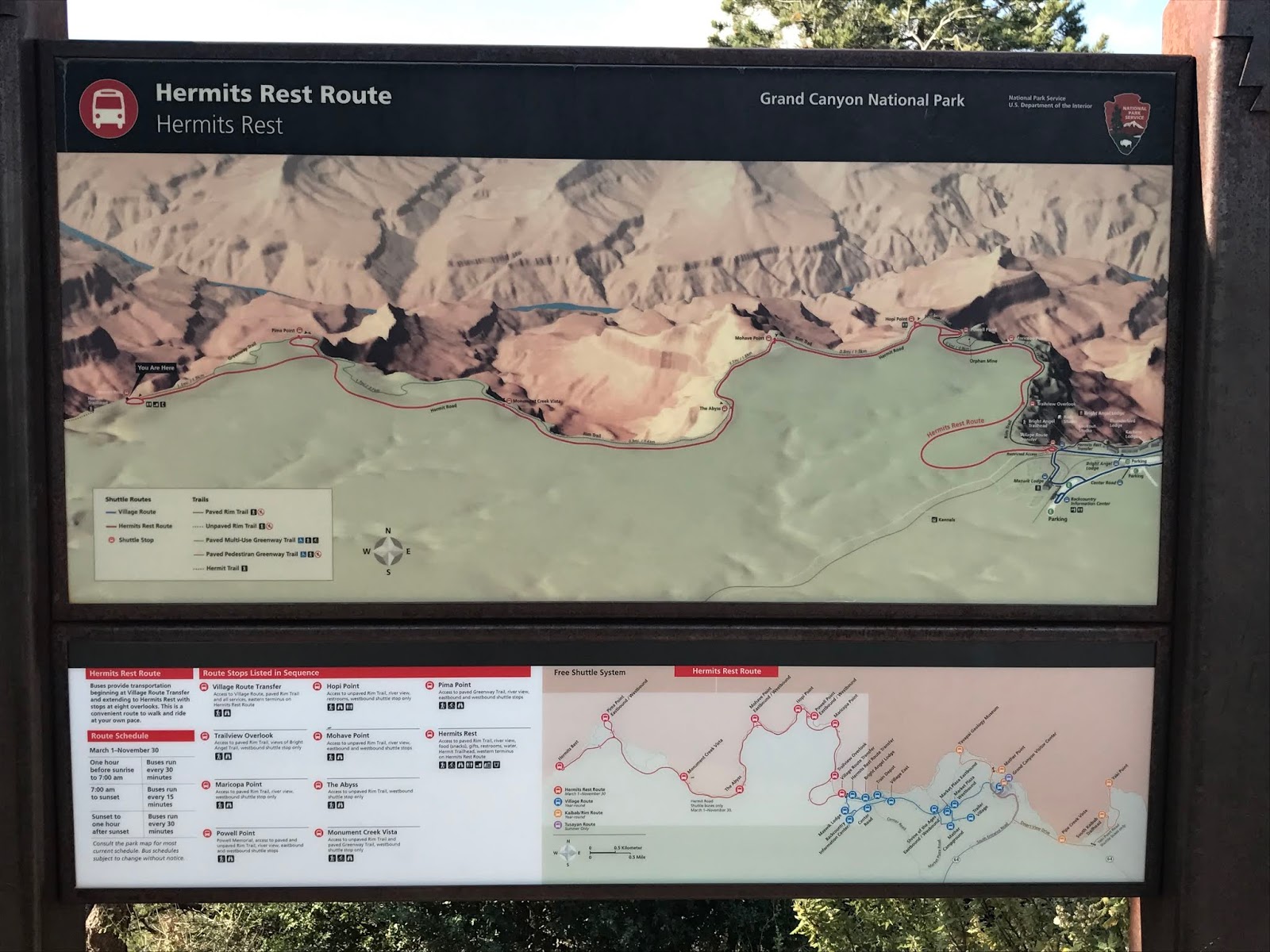
With bit of a sweat and anxiousness to visit Grand Canyon we reached the National Park Visitor's Center at South Rim. First thing is to get the map of National Park - study about the directions, various entrances and on the top of it Park Rangers are there to help you. We had many options to choose different routes but the best one and scenic, suggested by the Park Ranger was Hermitz Rest Route with Red Line. Route that covers the most geographical formations with the canyon view and that too during the available time slot!! Another 100% assured dart hit!!


The route is covered by the free ecofriendly shuttle service provided by the Grand Canyon National Park. The route begins from Bright Angel Point and goes till the end to Hermitz Rest. At the very starting point - Bright Angel we witnessed the magnificence of Grand Canyon and I got my answer of "The Why" and I smiled at myself!!


There are moderate to strenuous hikes starting from Bright Angel Point. One of them could be sighted here in the above click. I really admired inspired folks who were taking the 5 miles trail in such a hot shot weather. Be mindful of water as there are no water stops here on the trail and at the very entrance the board speaks a loud about this notice!!! Another interesting catch was each milestone at south rim stamps the historical age as if there’s a hidden time capsule beneath.


To name couple of lookout points on Hermitz Rest route and must watch are "Pima Point", "Mohave Point" and "The Abyss". The real grandness of Grand Canyon can be seen from Mohave Point  which has a fine view of the near vertical, 3,000 foot high cliffs that encircle The Abyss and continue towards Pima Point, two miles west. Then we caught the breath taking view of mighty Colorado making her way through the canyons for years together from Pima Point. 


Leave it as it is. The ages have been at work on it and man can only mar it - how truely said by Theodore Roosevelt!! One gets stunned to see nature's granduer and the splendid creation. The carving of Canyon is still going on and one can see the magnificent outcome. Just feel like storing everything in your eyesight forever.... and with that we came at the extreme end of the national park "Hermitz Rest". At the very end point of the rim there is a small shop situated on the cliff where once can sit back, enjoy the view of grand valley and also shop for souvenirs. 


Here are some facts about Grand Canyon (Source National park booklet and Wickipedia)

The Grand Canyon is a mile-deep gorge in northern Arizona. Scientists estimate the canyon may have formed 5 to 6 million years ago when the Colorado River began to cut a channel through layers of rock. ... The first Europeans to reach the Grand Canyon were Spanish explorers in the 1540s.

The canyon and adjacent rim are contained within Grand Canyon National Park, the Kaibab National Forest, Grand Canyon–Parashant National Monument, the Hualapai Indian Reservation, the Havasupai Indian Reservation and the Navajo Nation. President Theodore Roosevelt was a major proponent of preservation of the Grand Canyon area, and visited it on numerous occasions to hunt and enjoy the scenery. For thousands of years, the area has been continuously inhabited by Native Americans, who built settlements within the canyon and its many caves. The Pueblo people considered the Grand Canyon a holy site, and made pilgrimages to it. 


Still today Novajo Tribe ideally rules part of Grand Canyon which is not under National Park. The west rim with Glass Sky walk falls under this Novajo region. Much accessible and close from Las Vegas. 
The park has east, south, west and north entrances. Each entrance has it's own beauty just like the park has different beauty in each season!!

For kiddos to make this journey more interesting there are junior ranger badges. One can obtain those right at the beginning of park journey at Visitors center from Park Ranger. To know your park closely, study it and get your badge from the visitor's center once you submit the required covered paper based checkpoints/booklet based tasks. There are Park ranger led programs, tours and trails. If you want to really enjoy the park stay you can book your accommodation right in advance within the park itself. 


Or there are other private options like AirBnB or motels and hotels nearby. The convenient shopping is also available within the park area. The ecofriendly free shuttle service on various routes makes life much easier for those who want to sit back and relax and enjoy the natures bounty. 

With heart filled wish to return at another entrance one day we returned to Flagstaff.